![1858 Bronson Township, Michigan landownership map](images/maps/BranchBronson1858.png)
![1872 Bronson Township, Michigan landownership map](images/maps/BranchBronson1872.png)
![1915 Bronson Township, Michigan landownership map](images/maps/BranchBronson1915.png)
![2009 Bronson Township, Michigan map](images/maps/BranchBronson2009.png)
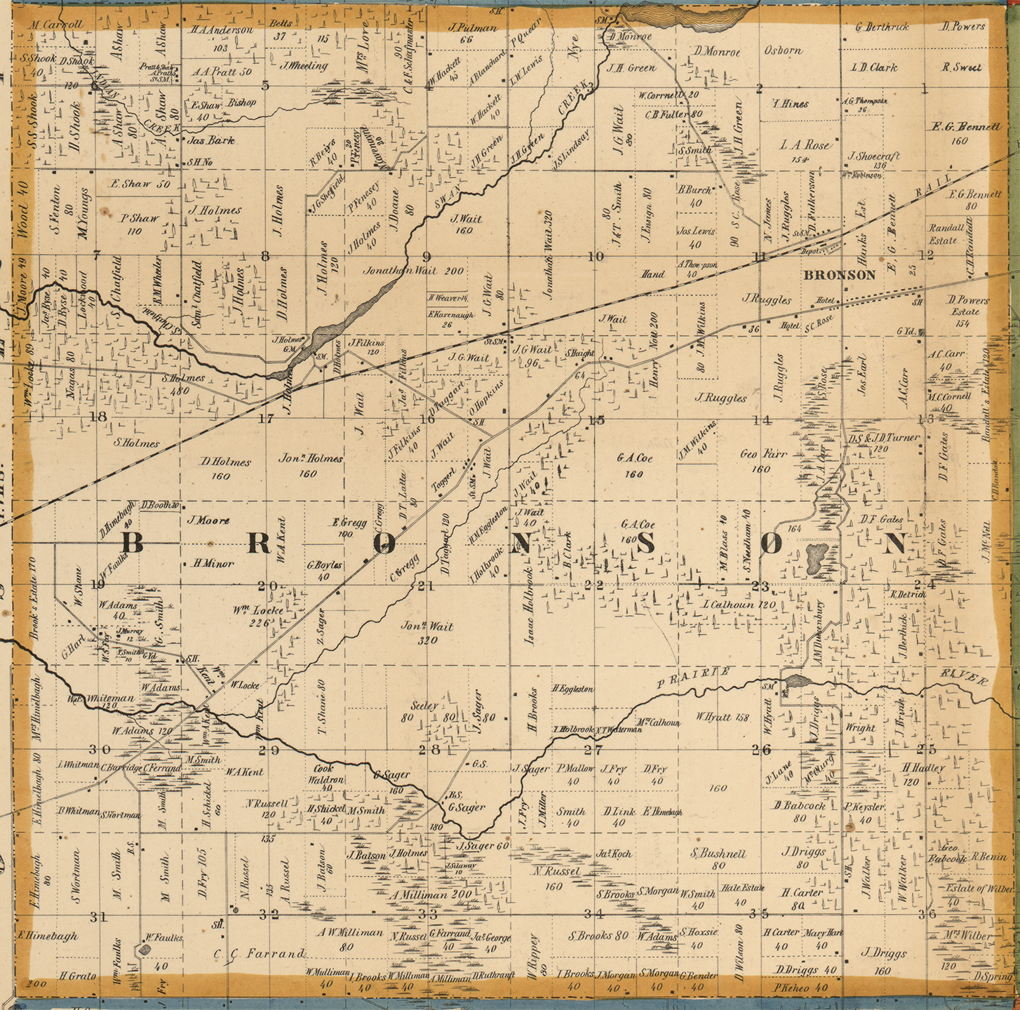
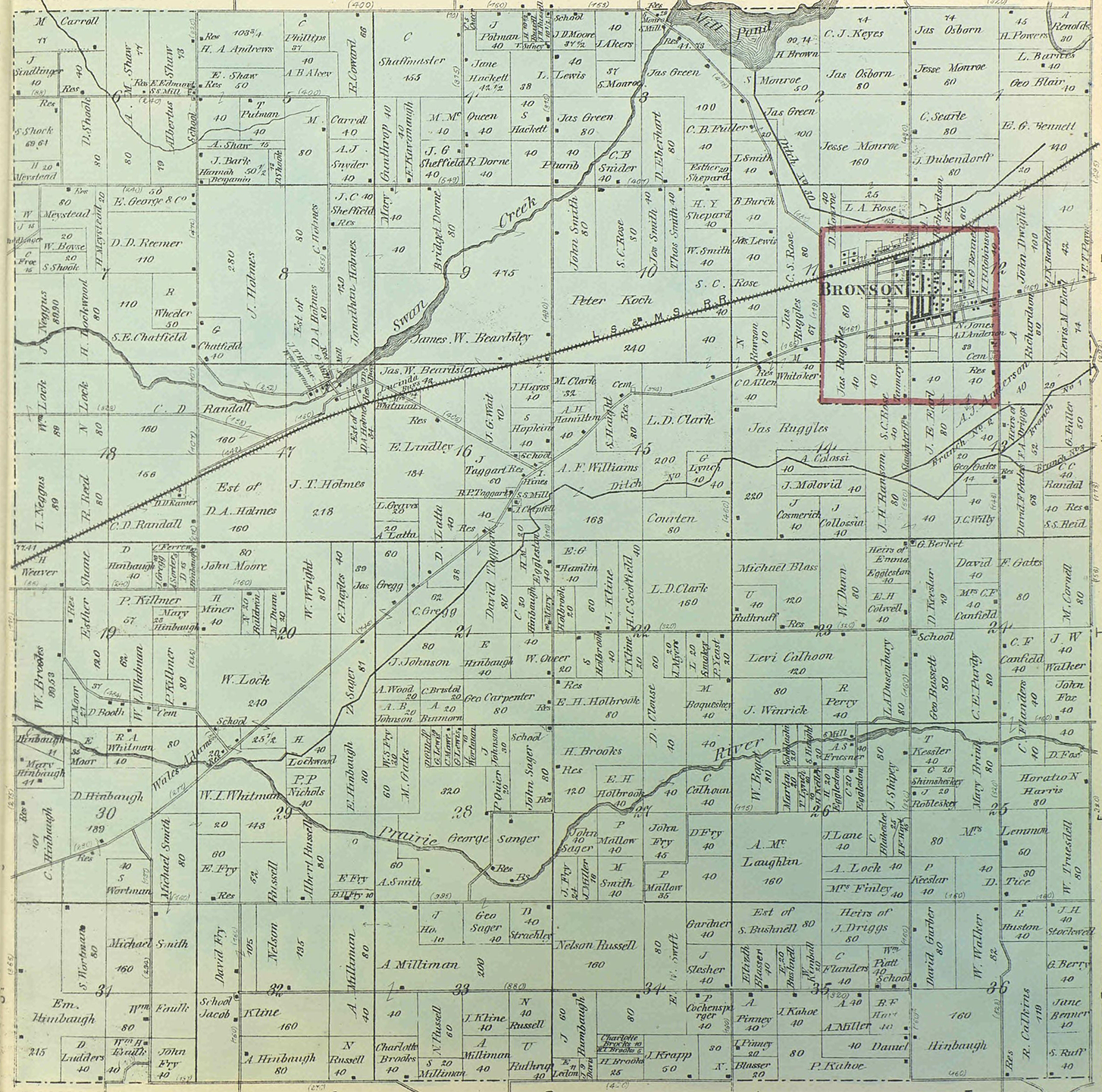
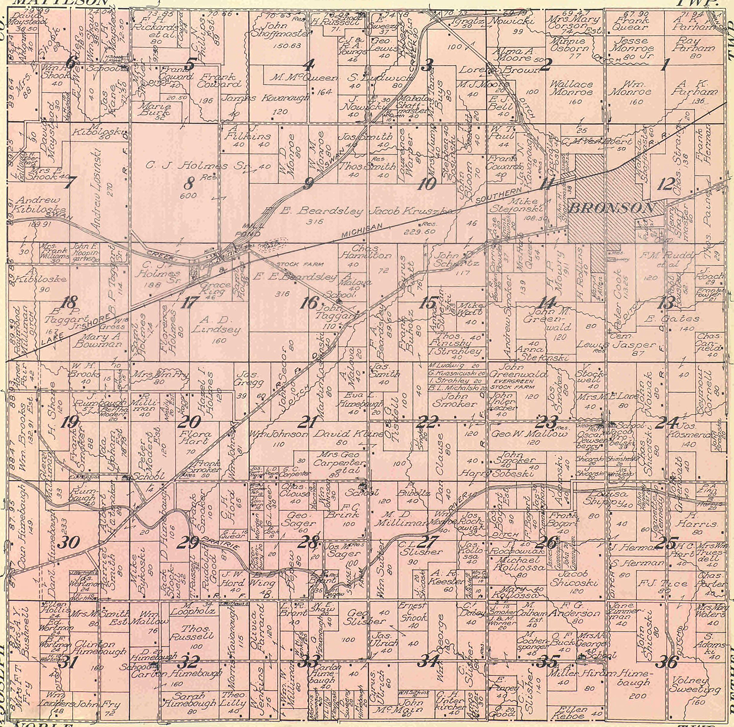
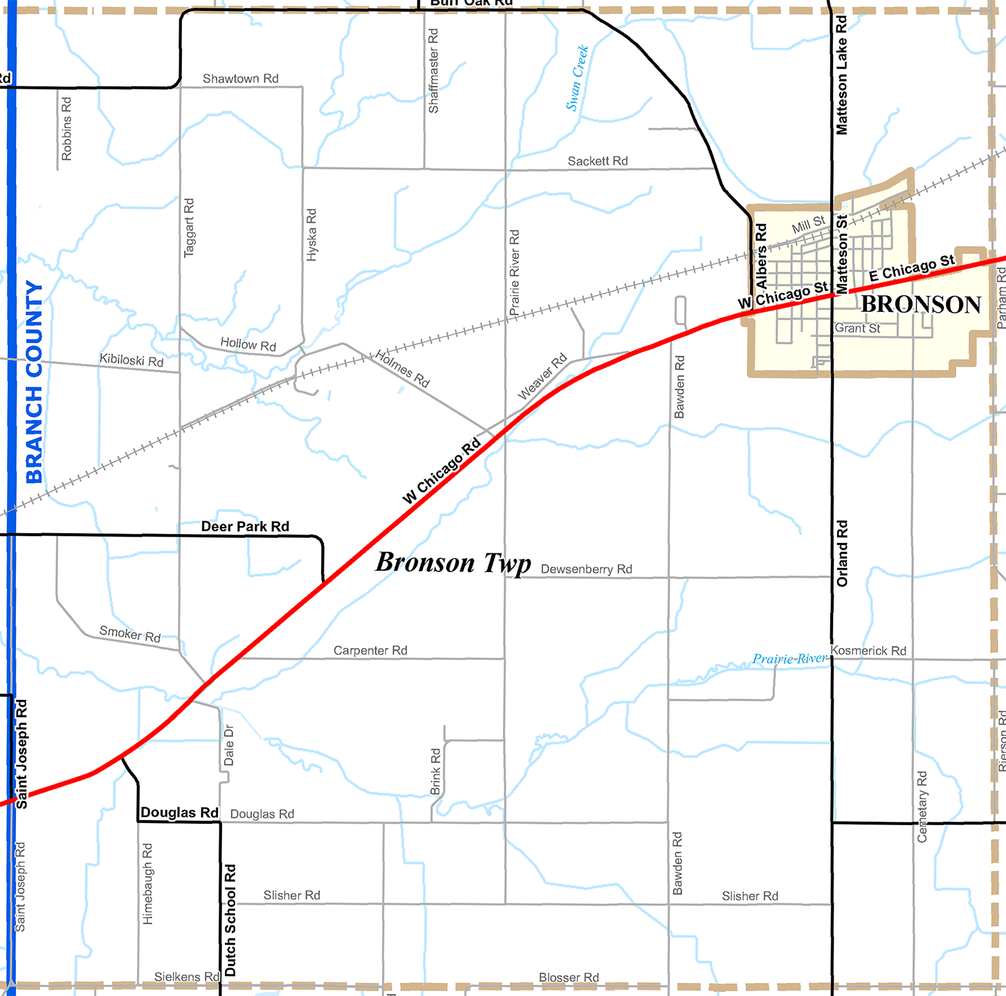
Choose a land-ownership map to view, and then use the opacity slider to overlay the historic map onto a 2010 census street map. Slowly change the opacity until you can see both maps clearly or view each map separately by moving the slider to the top or bottom.